Targeting Protected Areas to Meet Conservation Goals
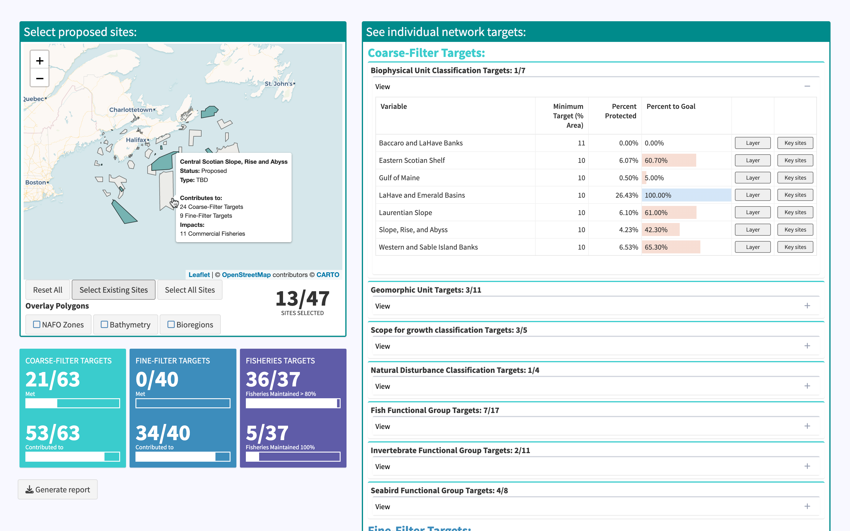
Here, I worked with a team from the Canadian Department of Fisheries and Oceans Marine Planning and Conservation Team to develop an interactive tool showing how implementation of proposed protected areas on Canada’s East Coast would contribute to over 150 quantitative conservation targets for the region.
I used the protected area network design and conservation priority spatial layers developed by DFO (see documentation here and here), along with the shiny, leaflet, and reactable R packages, and various javascript tricks to develop the application.
This application is now hosted on the internal-use shiny server for Fisheries and Oceans Canada, but the demonstration-only version is linked in the sidebar.