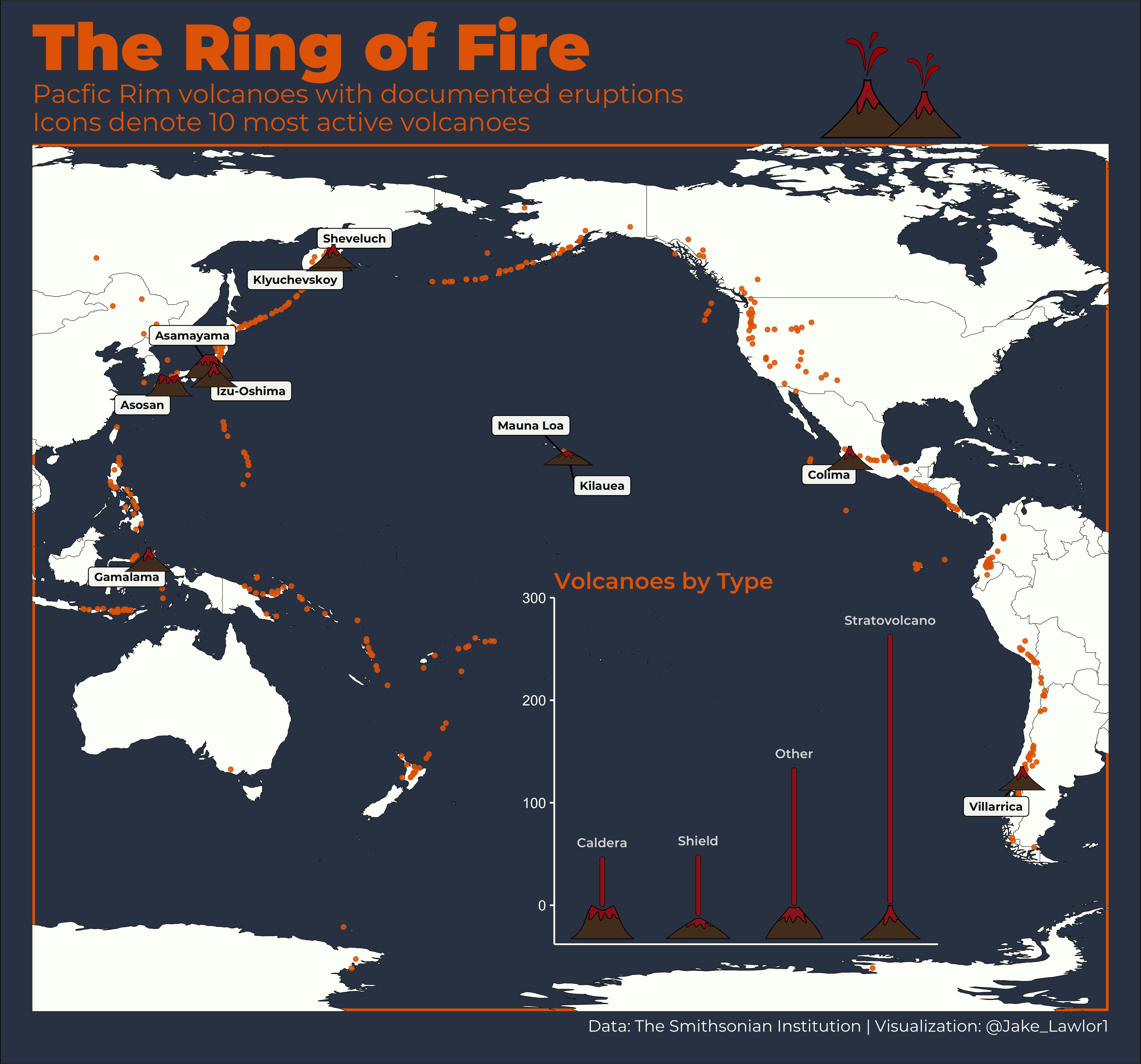
Ring of Fire Volcanoes
This plot is one of my contributions to the #TidyTuesday R social project. This plot uses rnaturalearth to map the locations of every volcano in the Pacific Ring of Fire, then uses ggimage to plot frequency of each type of volcanoes with custom png graphics that I developed in Inkscape Vector Graphics software. Code available in GitHub link in banner.